Alnwick Castle Historic Survey & 3D Laser Scanning Case Study

Alnwick Castle Historic Survey & 3D Laser Scanning Case Study

How do you capture one of the UK's most iconic castles using 3D scanning? Learn how our team at Luminous did just that, in this blog.

Alnwick Castle Model

High-Resolution Historic Building Survey at Alnwick Castle

Alnwick Castle is one of Britain’s most iconic historic landmarks and the second largest inhabited castle in the UK, surpassed only by Windsor Castle. With a history spanning over 950 years, the castle has undergone countless renovations, repairs, and conservation projects while remaining a fully operational heritage estate and visitor attraction.

Luminous were commissioned by Northumberland Estates to support the ongoing repair, conservation, and restoration works across the castle complex through advanced historic building survey and there UK 3D laser scanning services. Having worked closely with the Estates Department for many years, Luminous continue to provide accurate digital survey data to assist architects, conservation specialists, structural engineers, and heritage consultants involved in maintaining this nationally important historic structure.

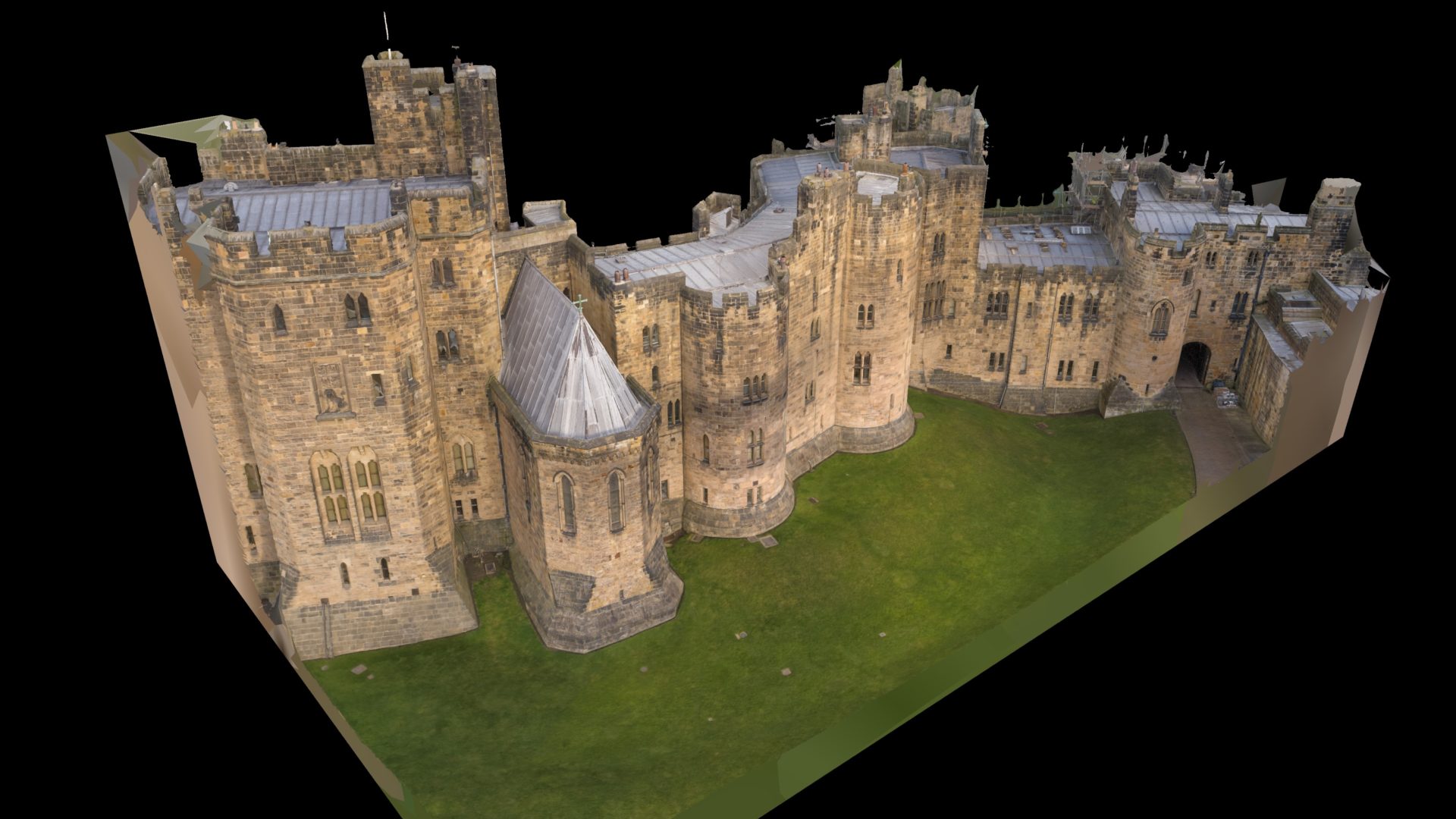
Alnwick Castle 3D capture.

Historic Building Survey Using Drone Photogrammetry & Laser Scanning

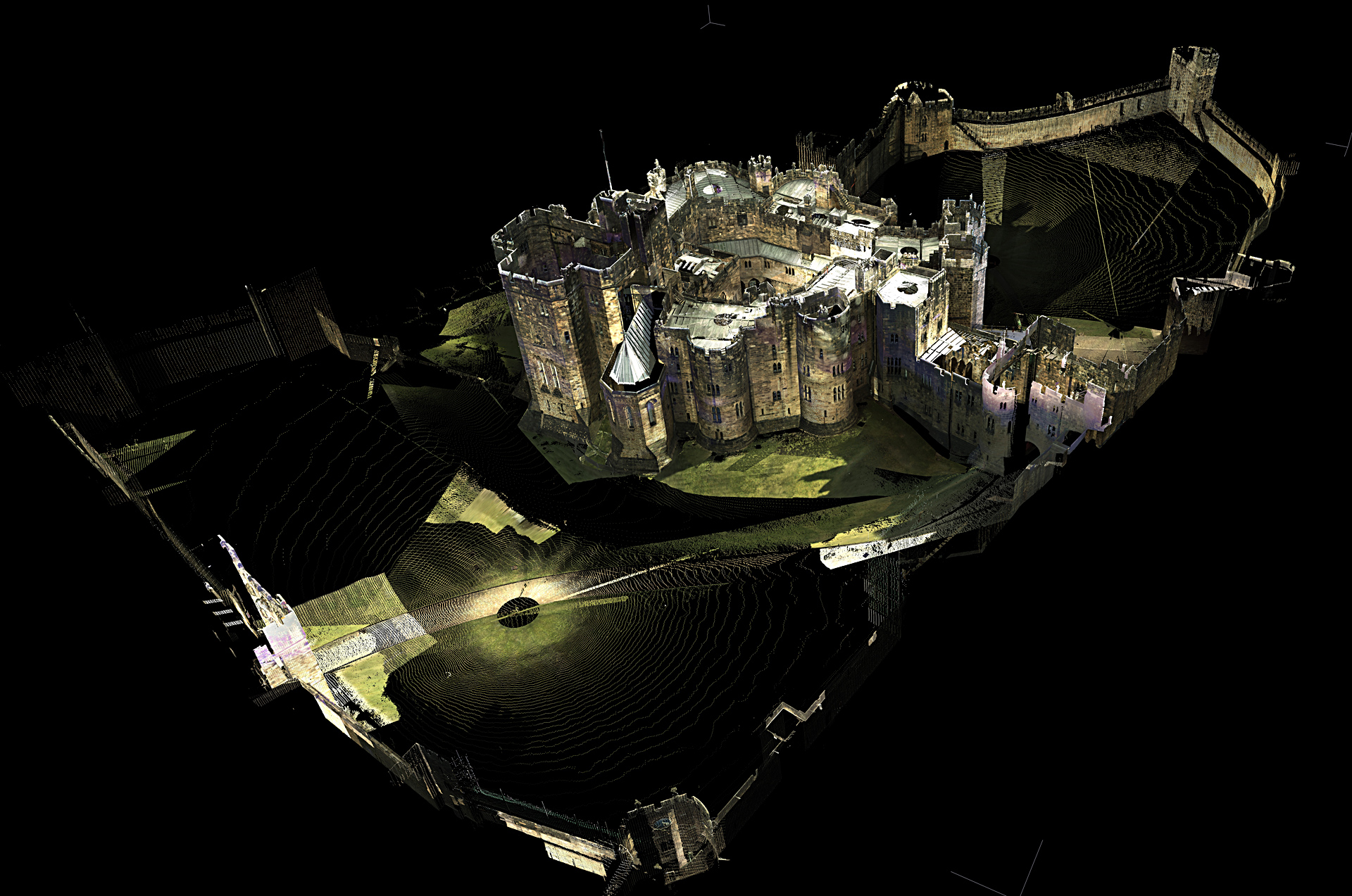
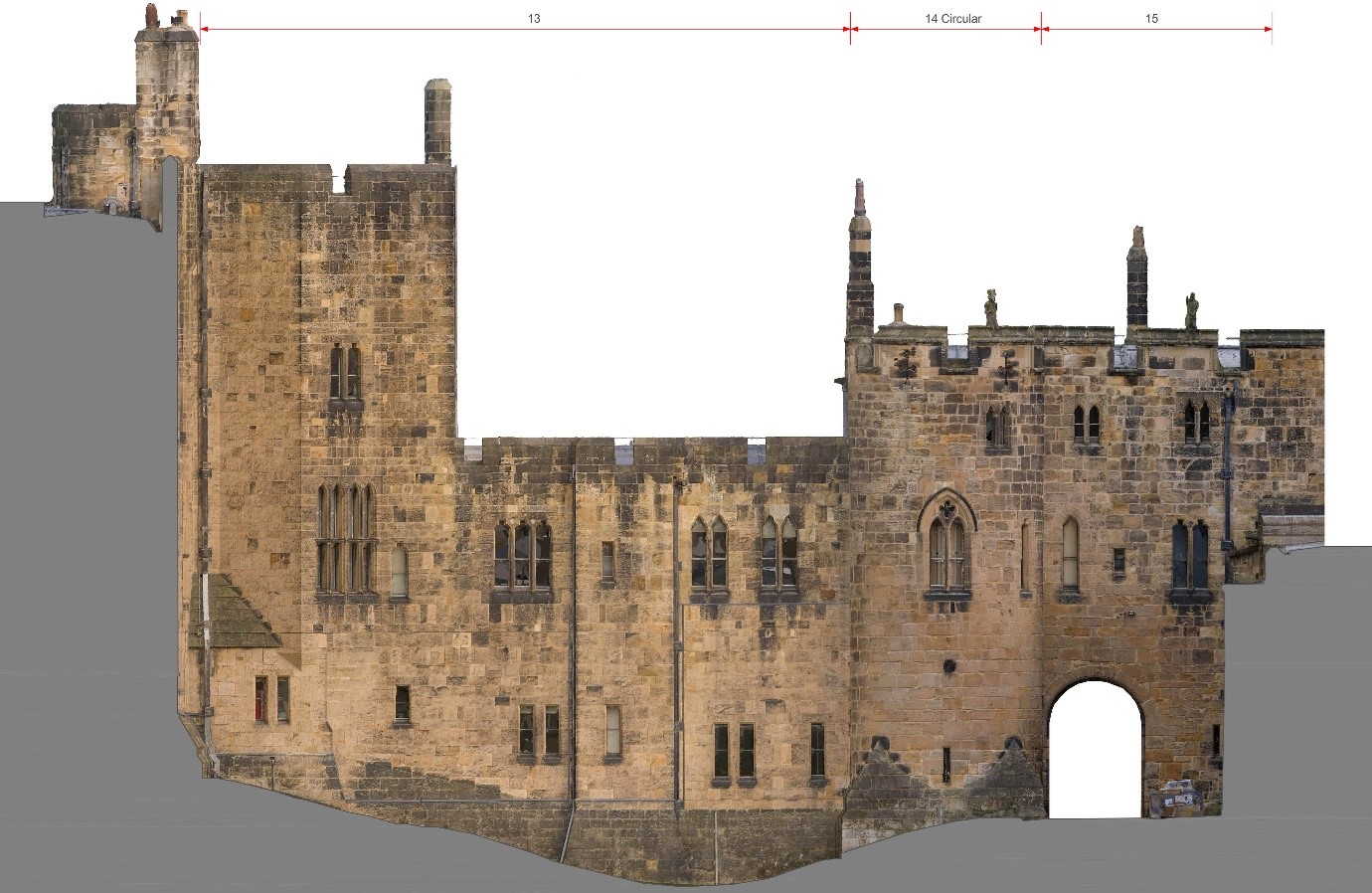
The original survey of Alnwick Castle was completed in 2014 using terrestrial 3D laser scanning technology to capture accurate measured survey data of the castle fabric. For the latest phase of works, Luminous transitioned to a drone-based photogrammetry workflow to improve efficiency and deliver ultra-high-resolution orthographic imagery alongside fully textured 3D models.

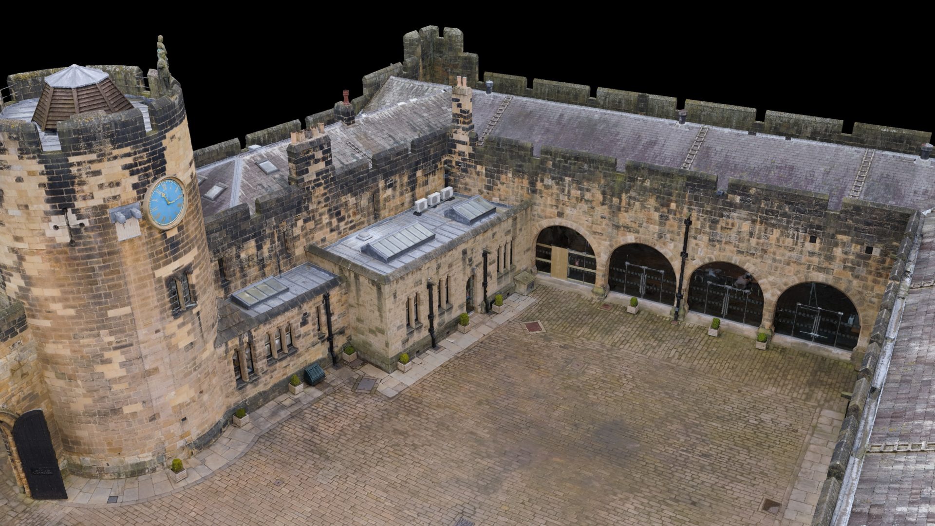
Using UAV drone surveying and photogrammetry techniques allowed Luminous to safely capture inaccessible roof areas, towers, parapets, elevations, and intricate stonework detail without the need for extensive scaffolding or access equipment.

The resulting survey data provides an accurate digital twin of the castle for conservation planning, defect analysis, condition monitoring, and future restoration works.

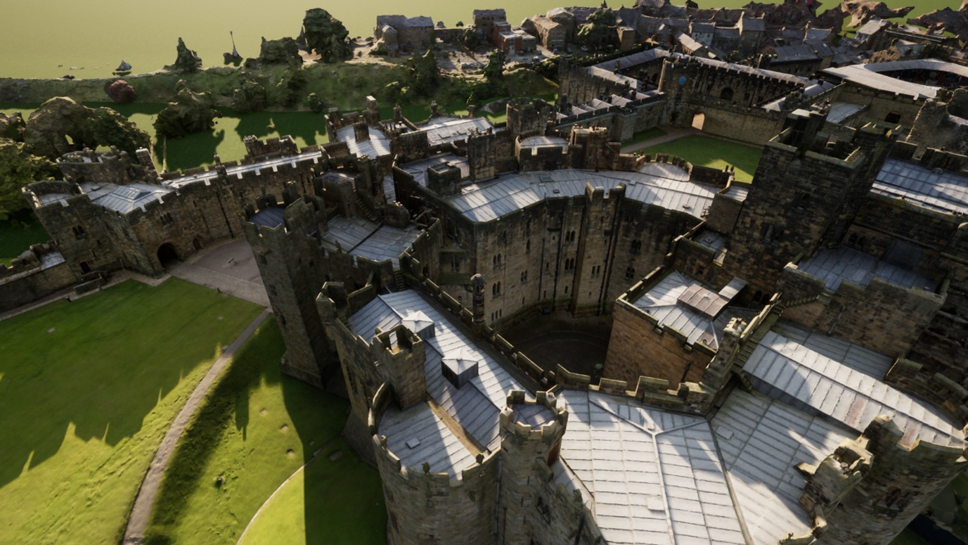
Alnwick Reality capture
Alnwick Castle 3D capture.
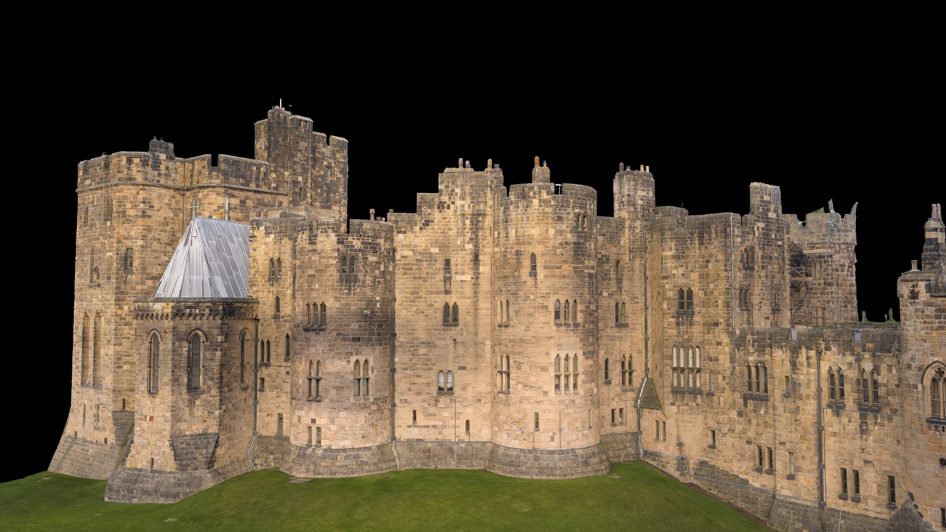
Alnwick mesh

Why Drone Surveying & Photogrammetry for Historic Buildings?

For complex heritage structures such as Alnwick Castle, drone photogrammetry offers several significant advantages over traditional survey methods:

Benefits of Historic Building Scanning & Photogrammetry

  • Safe access to difficult or hazardous areas
  • Capture roofs, chimneys, battlements, towers, and high-level masonry without working at height.
  • Highly accurate measured survey data
  • Generate scaled orthographic elevations, plans, sections, and 3D models suitable for conservation and restoration projects.
  • Detailed condition inspections
  • Identify stone decay, structural movement, weathering, cracking, and defects with millimetre-level detail.
  • Reduced scaffolding and access costs
  • Minimise disruption to occupied heritage buildings and reduce overall project costs.
  • Fast data capture across large historic estates
  • Efficiently survey extensive castle complexes and listed buildings in significantly less time than traditional methods.
  • Creation of permanent digital archives
  • Preserve a full digital record of heritage assets for future conservation, restoration, and historical documentation.
  • Enhanced visualisation and stakeholder communication
  • Produce realistic flythroughs, visualisations, and textured 3D models for architects, planners, heritage bodies, and estate management teams.
Alnwick Castle 3D capture.

Reality Capture Processing Workflow

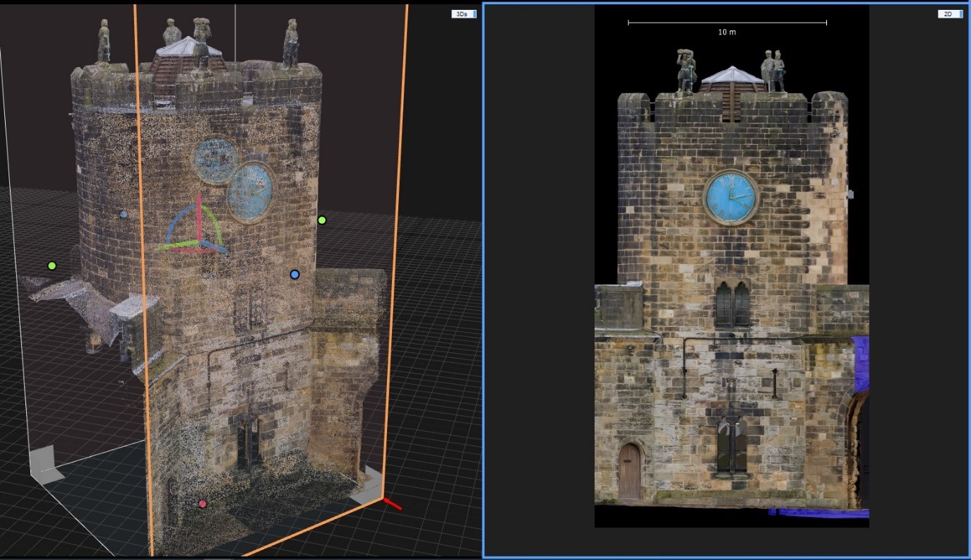
All drone survey data was processed using RealityCapture to produce a fully registered and textured 3D model of the entire site. Deliverables were issued on a phased basis to support ongoing restoration works before being merged into a complete castle model.

Survey & Processing Statistics

  • 12,471 individual drone images captured
  • Registered across 13 individual datasets
  • Exported as individual components
  • All components merged into a single master project

Processing Time for Complete Historic 3D Model

  • Alignment and merging of all components: 4 hours
  • Meshing of complete dataset: 24 hours
  • Final mesh count: 2.5 billion triangles
  • Processing storage requirement: Approximately 600GB
  • Mesh unwrapping: 30 minutes
  • Texturing process: 2 hours

Optimised 3D Models for Heritage Visualisation

Following the completion of processing, the master model was optimised for use across a variety of visualisation and CAD platforms used in heritage conservation and architectural design.

  • Model Optimisation Workflow
  • Mesh reduced from 2.5 billion triangles to 150 million triangles
  • High-resolution textures reprojected onto optimised geometry
  • Final outputs prepared for:Architectural visualisation
  • Heritage conservation planning
  • Repair scheduling
    Interactive flythroughs
  • 3D rendering and presentation
  • Long-term digital archiving

The optimised model enables stakeholders to accurately inspect and analyse the castle remotely while maintaining exceptional visual quality and geometric accuracy.

Supporting Heritage Conservation Through Digital Survey Technology

The Alnwick Castle project demonstrates how modern reality capture technologies such as laser scanning, drone surveying, and photogrammetry are transforming the way historic buildings are recorded, inspected, and preserved.

By combining heritage expertise with cutting-edge survey technology, Luminous continue to support conservation teams with accurate, reliable, and highly detailed survey information that informs restoration strategies and protects historic assets for future generations.

Services Provided

  • Historic building surveys
  • Heritage laser scanning
  • Drone photogrammetry
  • Measured building surveys
  • Orthographic elevations
  • 3D modelling & visualisation
  • Conservation survey support
  • Interactive Digital twin creation
  • UAV inspections for heritage assets